


Voting District 0084, El Paso County, Texas
About
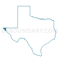
Outline

Summary
| Unique Area Identifier | 672910 |
| Name | Voting District 0084 |
| County | El Paso County |
| State | Texas |
| Area (square miles) | 182.22 |
| Land Area (square miles) | 181.83 |
| Water Area (square miles) | 0.39 |
| % of Land Area | 99.78 |
| % of Water Area | 0.22 |
| Latitude of the Internal Point | 31.92348190 |
| Longtitude of the Internal Point | -106.23489740 |
Maps


Graphs
Select a template below for downloading or customizing gragh for Voting District 0084, El Paso County, Texas


Neighbors
Neighoring Voting District (by Name) Neighboring Voting District on the Map
- Voting District 0047, El Paso County, TX
- Voting District 0055, El Paso County, TX
- Voting District 0061, El Paso County, TX
- Voting District 0062, El Paso County, TX
- Voting District 0085, El Paso County, TX
- Voting District 0097, El Paso County, TX
- Voting District 0098, El Paso County, TX
- Voting District 0109, El Paso County, TX
- Voting District 0146, El Paso County, TX
- Voting District 0155, El Paso County, TX
- Otero County Precinct 2, Otero County, NM
Top 10 Neighboring County Subdivision (by Population) Neighboring County Subdivision on the Map
- El Paso CCD, El Paso County, TX (550,597)
- El Paso East CCD, El Paso County, TX (160,404)
- El Paso Northwest CCD, El Paso County, TX (78,624)
- Southeast Otero CCD, Otero County, NM (13,108)
- El Paso North Central CCD, El Paso County, TX (11,022)
Top 10 Neighboring Place (by Population) Neighboring Place on the Map
Top 10 Neighboring Unified School District (by Population) Neighboring Unified School District on the Map
- El Paso Independent School District, TX (327,212)
- Ysleta Independent School District, TX (192,840)
- Socorro Independent School District, TX (179,910)
- Alamogordo Public Schools, NM (43,326)
- Clint Independent School District, TX (41,811)
Top 10 Neighboring State Legislative District Lower Chamber (by Population) Neighboring State Legislative District Lower Chamber on the Map
- State House District 75, TX (219,408)
- State House District 79, TX (147,172)
- State House District 77, TX (132,567)
- State House District 54, NM (30,120)
Top 10 Neighboring State Legislative District Upper Chamber (by Population) Neighboring State Legislative District Upper Chamber on the Map
Top 10 Neighboring 111th Congressional District (by Population) Neighboring 111th Congressional District on the Map
- Congressional District 23, TX (847,651)
- Congressional District 16, TX (757,427)
- Congressional District 2, NM (663,956)
Top 10 Neighboring Census Tract (by Population) Neighboring Census Tract on the Map
- Census Tract 9.02, Otero County, NM (9,941)
- Census Tract 103.25, El Paso County, TX (8,377)
- Census Tract 103.39, El Paso County, TX (8,264)
- Census Tract 103.11, El Paso County, TX (6,997)
- Census Tract 106, El Paso County, TX (6,146)
- Census Tract 3.02, El Paso County, TX (5,626)
- Census Tract 2.04, El Paso County, TX (5,283)
- Census Tract 103.22, El Paso County, TX (4,861)
- Census Tract 102.07, El Paso County, TX (4,803)
- Census Tract 2.06, El Paso County, TX (4,787)
Top 10 Neighboring 5-Digit ZIP Code Tabulation Area (by Population) Neighboring 5-Digit ZIP Code Tabulation Area on the Map
- 79936, TX (111,086)
- 79924, TX (59,058)
- 79938, TX (53,520)
- 79925, TX (40,641)
- 79904, TX (35,060)
- 79934, TX (19,174)
- 79935, TX (18,042)
- 88081, NM (15,708)
- 79906, TX (4,374)
- 79908, TX (3,673)